2025-26 Winter League #5 – Summit Trail/Rock Creek Natural Area
WINTER LEAGUE
Saturday, January 10 at Summit Trails/Rock Creek Natural Area in Maple Valley, WA
Meet Director: Michelle Kastner
- Pre-registration is required for ALL Winter League Events. There is NO day-of-event registration.
- Public Reg will close 1/7/26 at 11:59 pm for this meet.
- PUBLIC start time sign-ups are now part of the Public registration site (see under your Current Registrations). Sign-ups are open from December 20th at 3 pm to January 7th at 11:59 pm.
- ALL runners will be called to enter the start procedure line 8 minutes prior to their assigned/picked start time. Please be race-ready when your name is called.
- 2025-26 Start Procedures are here.
- 2025-26 WIOL Rules are here and the 2025-26 Public Rules are here.
- Site map is here.
- Start list is here.
Winter League is the Pacific Northwest’s premier competitive orienteering series for all ages.
- Elementary, Middle School, High School and College students compete under the banner of the Washington Interscholastic Orienteering League (WIOL).
- Winter League public courses offer a range of categories from a competitive long advanced category to non-competitive beginner-friendly categories at every event!
COURSES
Course designer(s): Chris Cooper & Ing Uhlin
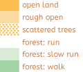
| Public Courses | |||
| Controls | Length | Climb | |
| Beginner | 10 | 1.5 km | 15 m |
| Advanced Beginner | 12 | 2.4 km | 20 m |
| Intermediate | 14 | 2.9 km | 30 m |
| Short Advanced | 14 | 3.4 km | 35 m |
| Long Advanced | 18 | 4.7 km | 50 m |
| WIOL Courses | |||
| Controls | Length | Climb | |
| Elementary | 10 | 1.5 km | 15 m |
| Middle School | 13 | 2.1 km | 20 m |
| Rookie-Female | 12 | 2.4 km | 20 m |
| Rookie-Male | 12 | 2.5 km | 20 m |
| JV Female / Collegiate JV | 14 | 2.9 km | 30 m |
| JV Male | 14 | 3.0 km | 30 m |
| Varsity | 16 | 3.5 km | 35 m |
| Collegiate Varsity | 18 | 4.7 km | 50 m |
How are courses measured?
Courses are measured as the crow flies, in a direct line from control to control. Unless you have wings, you will travel farther than this distance! Courses are measured in kilometers, so a good rule of thumb is to simply round up to miles to estimate how far you will go. So in a 5 kilometer race, you’ll likely travel up to 5 miles.
COURSE NOTES
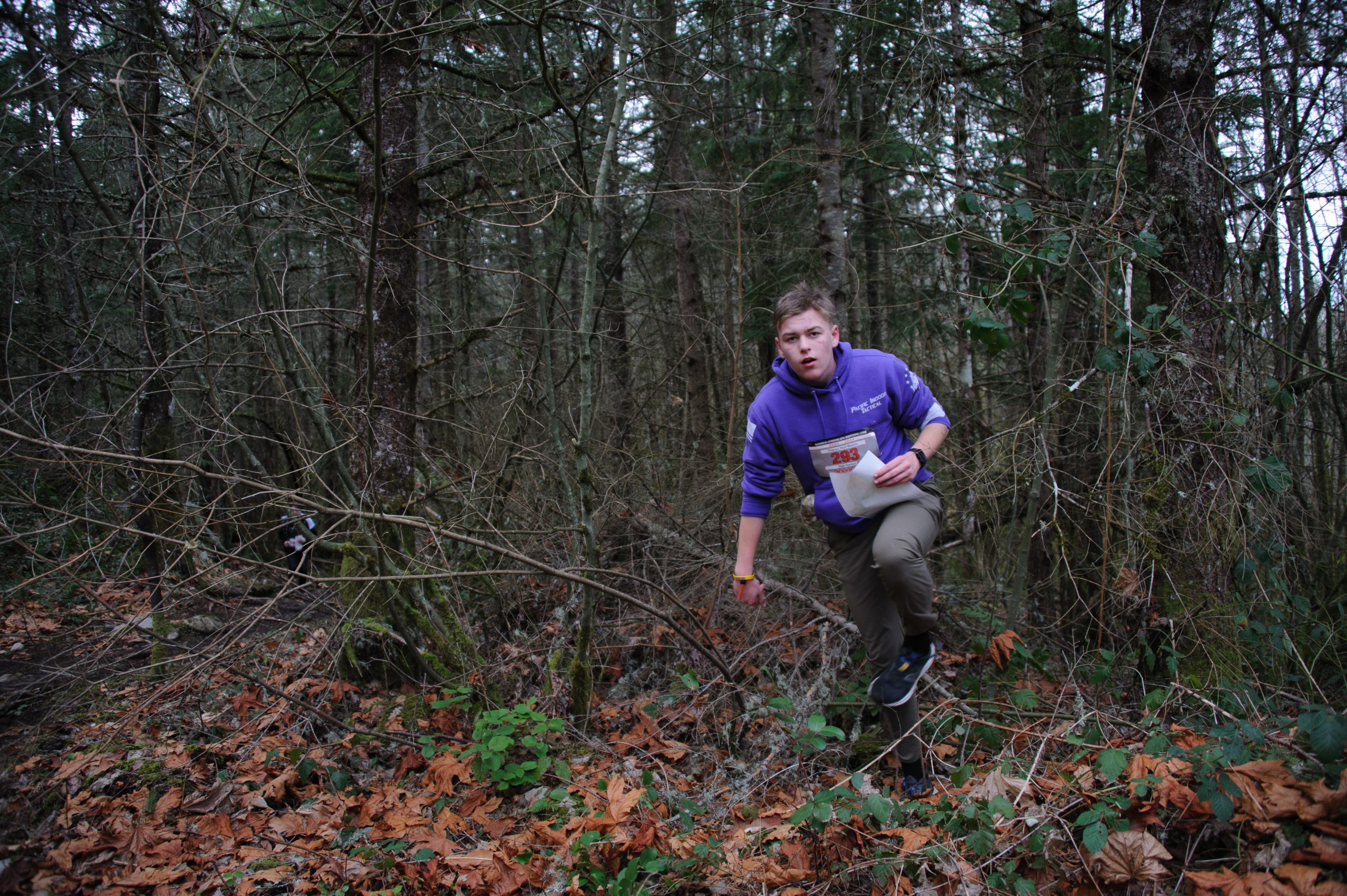
It’s time for another foray into the woods of Maple Valley! Thanks to John B, Sophie H, Tallie M, and Luke M who have spent a considerable amount of time this past year updating the Summit Trail map, we have newly mapped areas available to orienteers and a map that is as dialed as ever! We are grateful for their hard work and time spent on a very challenging map update.
As is with all map updates, the venue begins to change the moment the fieldwork is complete. Recent windstorms have dropped a copious number of new trees; flooding has increased the size of marshes, and the elk are especially disgruntled. Recent storm impacts to the venue can pose a challenge to off trail route finding, cover point features with branches, and introduce unmapped root stocks. In addition, the ever-encroaching vine maples have made some of these forested passages challenging to traverse. Since these impediments are random and constantly changing, they are not marked on the map.
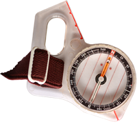
None of the courses’ controls are intentionally hidden but knowing which side of the feature the control is located will help determine your angle of approach. Knowing your control feature and evaluating the control location before you set out on your next leg will help reduce the amount of time you spend wandering around in the forest. If you are not familiar or comfortable with the use of your compass, we highly recommend you swing by Caroline’s training tent where there will be a compass course set up in the field west of the start tents.
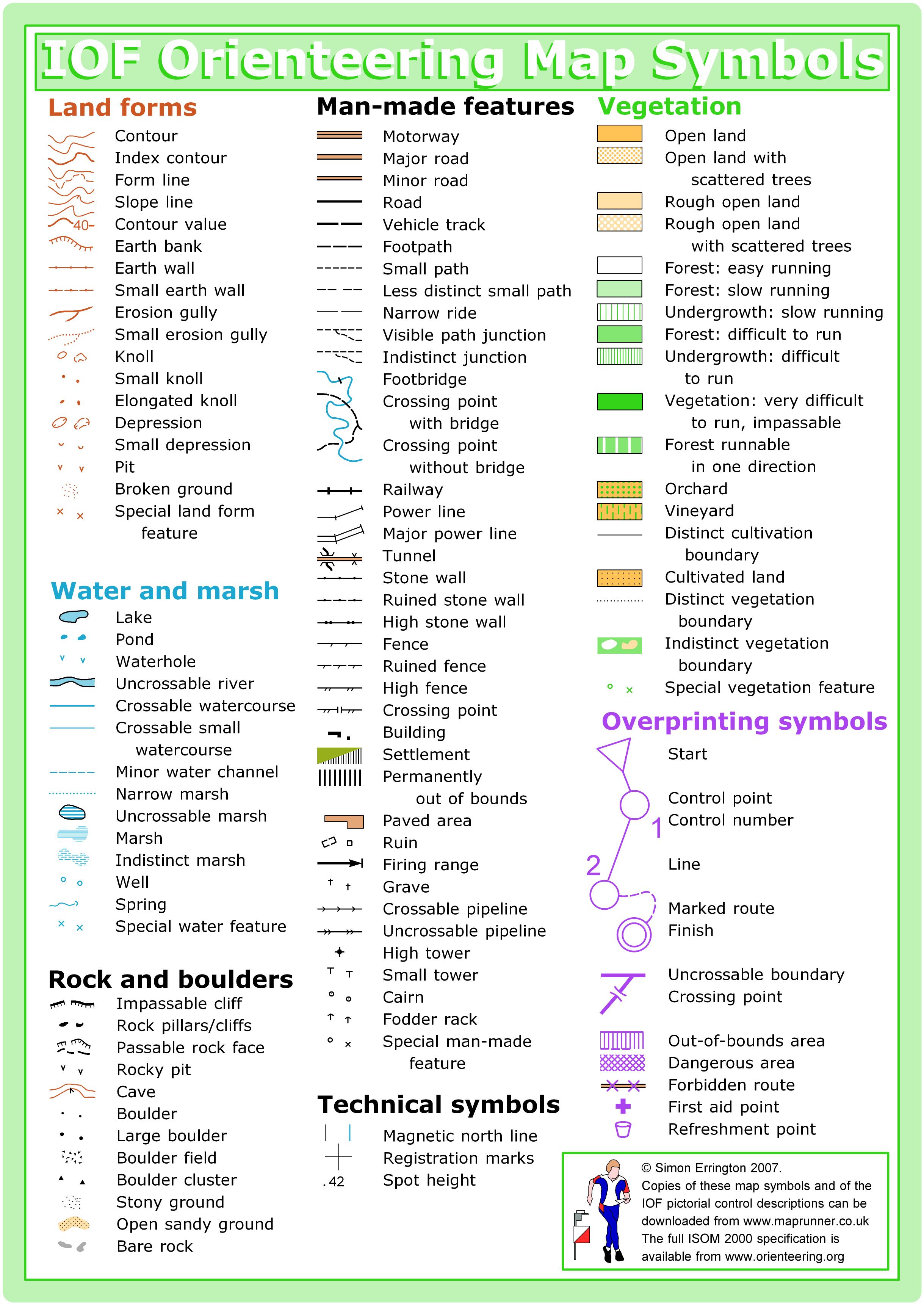
In order to increase map legibility and assist with off trail navigation, for this event the “Small Knoll (109)” symbol has been removed from the base map. There are just too many knolls within the venue to make this feature useful for navigation. You will still be able to see major knolls marked with the “Small Elongated Knoll (110)” symbol on the map.
There is an extensive elk and deer herd that call this area home, and there is a vast network of elk trails. These elk paths are represented by white stripes on the map between thicker vegetation, meaning it is not a maintained trail, and subject to nature’s adjustment should it occur.
The only stumps mapped at Summit Trails are very large: at least 2 m in height and 1.5 m in width. On the map, stumps are marked with brown X. Rootstocks greater than 1 m (and most often) visible from all directions are mapped with a brown triangle.
Course Specific Notes: (keep in mind that the difficulty levels typically are increased between the first and second half of the series)
- Elementary and Beginner Course: Not all controls are placed at decision points, and some are placed beyond trail junctions. However, you should be able to see the next control from the center of the trail junctions.
- Middle School, Rookie, and Advanced Beginner Courses: Some of your controls have been placed up to 10 m from the trails. All controls can be seen from distinct points on the trail. The use of a compass from a known point on the trail will be especially beneficial. Also, it is possible to travel off trail between some controls. However, this is never the best route choice.
- Junior Varsity and Intermediate Courses: Some course legs have been designed to offer off-trail route choices. Most of these off-trail route choices follow distinct handrails or provide significant catching features. Have a solid navigation plan before jumping off the trail. If you are unfamiliar with the use of handrails or catching features, please swing by the training area and learn from the best! Also, make sure you brush up on those compass skills!
- Varsity, Collegiate, and Advanced Courses: You got this! Have fun! Be very careful when crossing roads.
Horses and equestrians: The trails of Summit Trail are also used by equestrians. When encountering horses, please move to the side of the trail and call out to the riders. Make reasonable efforts not to spook the horses and announce your presence to riders as the horse approaches.
Travel in opposite directions: You may encounter reverse travel on some single-track trails. To keep everyone safe, please step off the trail when studying your map, slower runners step aside for faster runners and faster runners please safely pass those running slower than your pace.
Lastly, both deer and hiking trails within the Summit Trail venue are lined with blackberries and nettles. We strongly recommend pants and long-sleeved shirts for all runners. Please do not underestimate the amount of damage the vegetation can do to bare legs. Wear pants!!!
Have fun and enjoy the courses.
Ing & Chris
SCHEDULE
This event is Pre-Registration Only.
9:00 am – Training begins
9:00 am – Info tent and newcomer instruction opens
9:34 am – Start process begins
9:42 am – First start
12:30 pm – Last start
2:30 pm – Course closure
Why is there a start window?
This event uses an interval start, which means that participants are started in waves instead of all at once. When you arrive at the start tent, find the chute for your course and follow the start volunteer’s instructions.
PRICES
PRE-REGISTRATION PRICES
$22 base price
– subtract $5 for CascadeOC members
– subtract $5 for using your own e-punch
Participating as a group? Just $5 for each additional adult (18+) group
member, no cost for additional minors. Max group size is 4 participants.
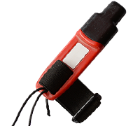
What’s an e-punch?
An e-punch records your race. At each control, you’ll dip the e-punch into an electronic box, which will beep and flash as confirmation. After you finish, you’ll download the e-punch at the download tent and get a receipt that show which controls you visited and how long you took between each; these are your “splits.”
Part of the fun of orienteering is comparing your splits with people who completed the same course, and discussing the routes you took!
SIGN UP
There is no Day-of-Event registration. Pre-registration will close Wednesday 1/7/2026 at 11:59:00 PM.
Remember to also sign up for a start time for public runners. Start time sign-ups for WL #5 will be open from December 20th at 3 pm to Jan 7th at 11:59 pm.
LOCATION
CARPOOL
Looking for a carpool? Join the club email group and share your request to find a ride.
THE MAP
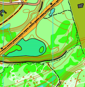
Summit Trails/Rock Creek Natural Area is part of the larger Danville-Georgetown Open Space. This moderately flat area has numerous contour and vegetation features, such as stumps, rootstocks, depressions, and knolls. Passage through the trees is often possible using faint elk trails. Adjacent to Summit Trail Middle School, which is generally the event center. Please note that no dogs are allowed on the campus of Summit Trails Middle School.
Read more on the map pageSAFETY & ETIQUETTE
Return to the Finish
All participants MUST return to the finish and download their e-punch or turn in their punch card.
Even if you have not finished your course, you must still return to the the finish and confirm with event staff that you have returned safely.
Out of Bounds
Some areas may be marked out of bounds. It is imperative to respect these boundaries to maintain our relationships with land managers. Participants MUST NOT go out of bounds. Any participant caught going out of bounds will be disqualified.
Course Closure
All participants MUST return to the finish by course closure time. If a participant does not return by course closure, event volunteers will begin coordinating a search party.
If you need a long time on the course, start as early in the start window as possible, wear a watch, and be prepared to cut your course short to make it back by the course closure time.
Whistle
All participants MUST carry a whistle on the course. Complimentary whistles are available at the start tent (please only take one).
If you are injured on the course and need assistance, blow three long blasts to call for help.
If you hear a call for help, abandon your course to find the person in distress.
Voices
Part of the fun and fairness of orienteering is navigating your own course, so please be polite when you find a checkpoint and don’t holler that you’ve found it.


