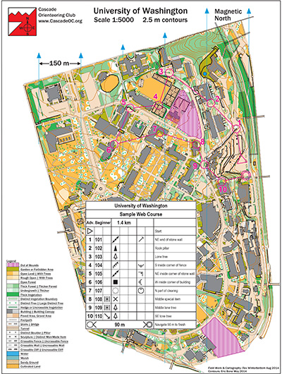
University of Washington has a LOT of buildings–some arranged north/south, some at a 45-degree angle, some at no particular angle, and most along two curving roads, criss-crossed with acres of angled paths, sidewalks, and individually-mapped trees. Now run it, while keeping all the angles, buildings and roads straight in your route planning!
Note: Samples of the map are provided here for educational purposes only; the map shown here is not kept up-to-date. The course shown is a Beginner/Intermediate course, and actual controls do not exist in the terrain.
The purpose of providing these navigational and physical ratings below is to provide greater context for how challenging an orienteering course at this venue might be. For example, an advanced-level course at a local city park will be easier to complete than an advanced-level course in the mountains.