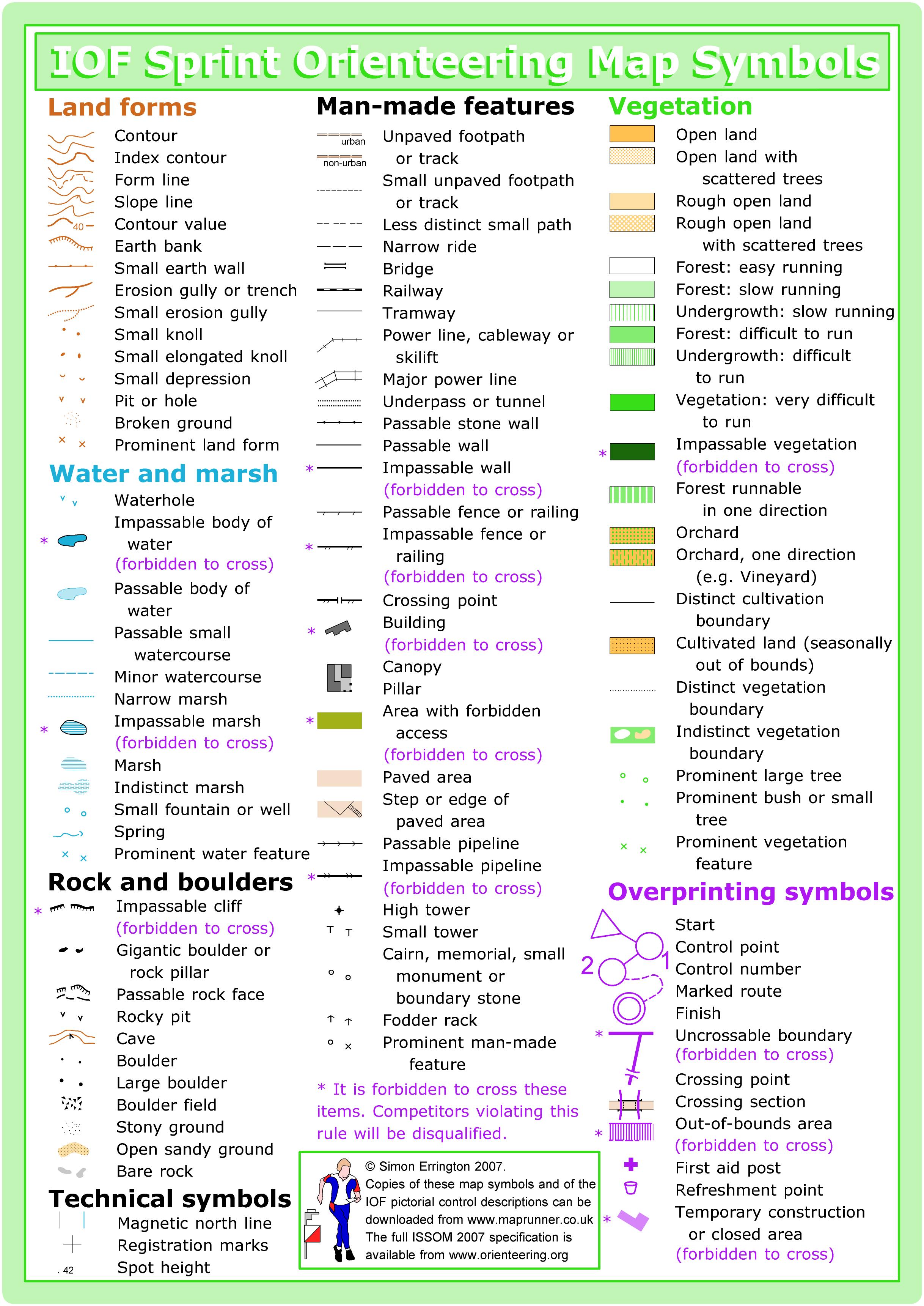
This venue is mapped to sprint standard (or ISSOM, the International Specification for Sprint Orienteering Maps). The sprint standard has a few key differences from traditional orienteering maps (or ISOM, the International Specification for Orienteering Maps):
- Some features can be marked as uncrossable (illegal to cross)
- Out-of-bounds is represented by olive green, which is used often for flower beds or private areas
- Footpaths and paved areas appear tan
- There are additional urban symbols, including canopies, which illustrate covered passageways
FOR THIS EVENT, SHORELINE CC IS OUT OF BOUNDS.
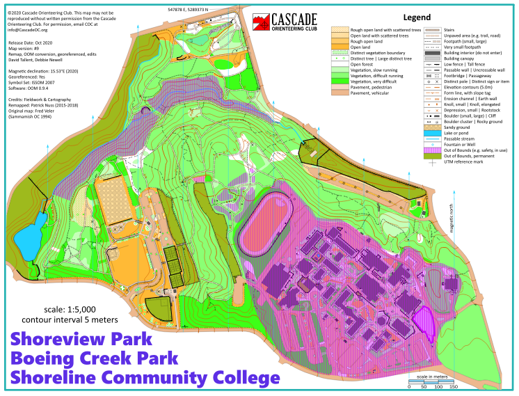
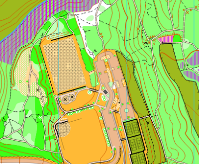
Note: Samples of the map are provided here for educational purposes only; the map shown here is not kept up-to-date.
For this event, Shoreline Community College is OUT OF BOUNDS.
The purpose of providing these navigational and physical ratings below is to provide greater context for how challenging an orienteering course at this venue might be. For example, an advanced-level course at a local city park will be easier to complete than an advanced-level course in the mountains.