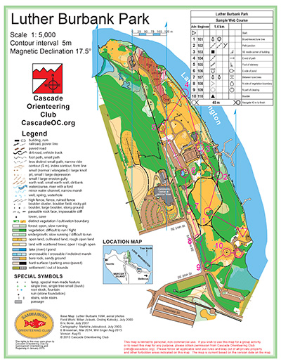
Luther Burbank Park is a long, narrow park with a number of different micro-areas. At the south end, near the parking, is a grassy area, beach and distinctive landform sculpture. This is where events usually start. To the west, connected only by trail, is a campus and garden areas. To the north, through the woods, is another parking area and playground, and another open area. And further north is a dog park and yet another open area.
Together, these form a lot of open, grassy areas, but because they are compartmentalized, the park feels bigger than the 1:5,000-scale indicates, and it is feature-rich for city park course design.
Note: Samples of the map are provided here for educational purposes only; the map shown here is not kept up-to-date. The course shown is a Beginner/Intermediate course, and actual controls do not exist in the terrain.
The purpose of providing these navigational and physical ratings below is to provide greater context for how challenging an orienteering course at this venue might be. For example, an advanced-level course at a local city park will be easier to complete than an advanced-level course in the mountains.