2026 Ultimate Orienteer #5 – Jack Creek (Middle)
 Event #5/9 in the Ultimate Orienteer Series!
Teanaway Doubleheader – Part 1
Head east for a doubleheader near Cle Elum! In this edition, we start with Jack Creek for a Middle Distance event and then move to Dickey Creek for a Long Distance event!
- Saturday, May 16 – Jack Creek, Middle
- Sunday, May 17 –Dickey Creek, Long
Camping/Lodging
There’s free camping near Teanaway and a selection of hotels in Cle Elum.
Other things to do
See Discover Cle Elum for information about things to do in and near Cle Elum.
COURSES
Course designer(s): Tim Potter
| Course | Controls | Length | Climb |
| Beginner | 8 | 2.0 km | 40 m |
| Intermediate | 11 | 3.2 km | 40 m |
| Short Advanced | 10 | 3.9 km | 100 m |
| Medium Advanced | 12 | 5.2 km | 90 m |
| Long Advanced | 15 | 6.1 km | 115 m |
Middle Course/Class Assignments for Ultimate points
If you want to earn Ultimate points, check the table below to see which category you should sign up for. Find your age class in the left column, then follow the row across to the right until you find the dark orange cell. That is your “assigned” category.
For example, if you’re a female 16 or under, your Ultimate age class is F-16 and, for this event, is assigned to the Intermediate course. If you are up for a more challenging course, you can also earn points in F-20 on the Short Advanced course, or F-21+ on the Medium Advanced course. Just keep in mind that other courses are more difficult, both navigationally and physically. Also keep in mind that you’ll be earning points only in the class you sign up for.
| Age Class | Course |
| • Female 16 and Under • Open 16 and Under |
Intermediate |
| • Female 20 and Under • Female 60+ • Female 70+ • Open 70+ |
Short Advanced |
| • Female 50+ • Open 50+ • Open 60+ • Female 21+ • Open 20 and Under |
Medium Advanced |
| • Open 21+ | Long Advanced |
Recreational classes
If you don’t care about Ultimate points, sign up for a Rec category on the course of your choice.
How are courses measured?
Courses are measured as the crow flies, in a direct line from control to control. Unless you have wings, you will travel farther than this distance! Courses are measured in kilometers, so a good rule of thumb is to simply round up to miles to estimate how far you will go. So in a 5 kilometer race, you’ll likely travel up to 5 miles.
COURSE NOTES
These middle length courses are designed to challenge your navigation skills with bearing and sighting, bearing off, pace counting, and making adjustments for vegetation required as the courses get more advanced.
The map required a few updates for trails that have disappeared and to add boulders that have appeared. Some of the trails that remain on the map are faint and in some outer areas of the map, you may find some unmapped faint trails. For the beginner course, there will be some flagging where trails get faint.
The vegetation mapping was done several years ago and you will find a good amount of additional growth in some areas. Be careful about counting on vegetation to be a definitive navigational feature. There are also some areas with many unmapped rootstocks and stumps (from rot and tree thinning over the years), so be sure to navigate to the circle and not just look for rootstocks or stumps. A special map symbol you will see on this map is logging debris (brown circle with a dot at the center), which might help you locate yourself.
In my early scouting, I saw elk twice, but I’d expect they have moved to higher country by now. In my experience, they are very shy and are usually running away by the time I see them. I did see a skunk in the NW part of the venue (which is my first Cascades Skunk, so very cool). Keep an eye out for the skunk and keep your dogs under control. Luckily, my dog was very good and did not get sprayed. 🙂
The course will be very dry by the time of the event and there will be no water on the course, so carry all of the water that you need.
Safety bearing is WEST, which will drop you into the main road that runs by 29 Pines campground. A safety bearing SOUTH will also lead you to a gravel road and then head SW to the main road.
All in all, this should be a fun race in dry pine forest.
Tim Potter
6/1/2025
SCHEDULE
Preliminary schedule
9:00am-11:15pm – Check-in
9:30am-11:30am – Starts
9:30am-10:30am – Newcomer instruction
2:00pm – Courses close*
*Wear a watch to ensure that you return to the finish by course closure time, even if you have to abandon your course to do so. Those returning after course closure will be disqualified and will make the volunteer staff very grumpy.
Why is there a start window?
This event uses an interval start, which means that participants are started in waves instead of all at once. When you arrive at the start tent, find the chute for your course and follow the start volunteer’s instructions.
PRICES
PRE-REGISTRATION PRICES
$22 base price
– subtract $5 for CascadeOC members
– subtract $5 for using your own e-punch
Participating as a group? Just $5 for each additional adult (18+) group
member, no cost for additional minors.
Maximum group size is 4 (including the group leader).
What’s an e-punch?
An e-punch records your race. At each control, you’ll dip the e-punch into an electronic box, which will beep and flash as confirmation. After you finish, you’ll download the e-punch at the download tent and get a receipt that show which controls you visited and how long you took between each; these are your “splits.”
Part of the fun of orienteering is comparing your splits with people who completed the same course, and discussing the routes you took!
SIGN UP
LOCATION
PARKING
Parking is available in the nearby Twenty-nine Pines campground. Please carpool.
CARPOOL
Looking for a carpool? Join the club email group and share your request to find a ride.
THE MAP
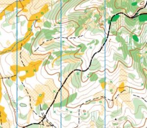
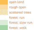
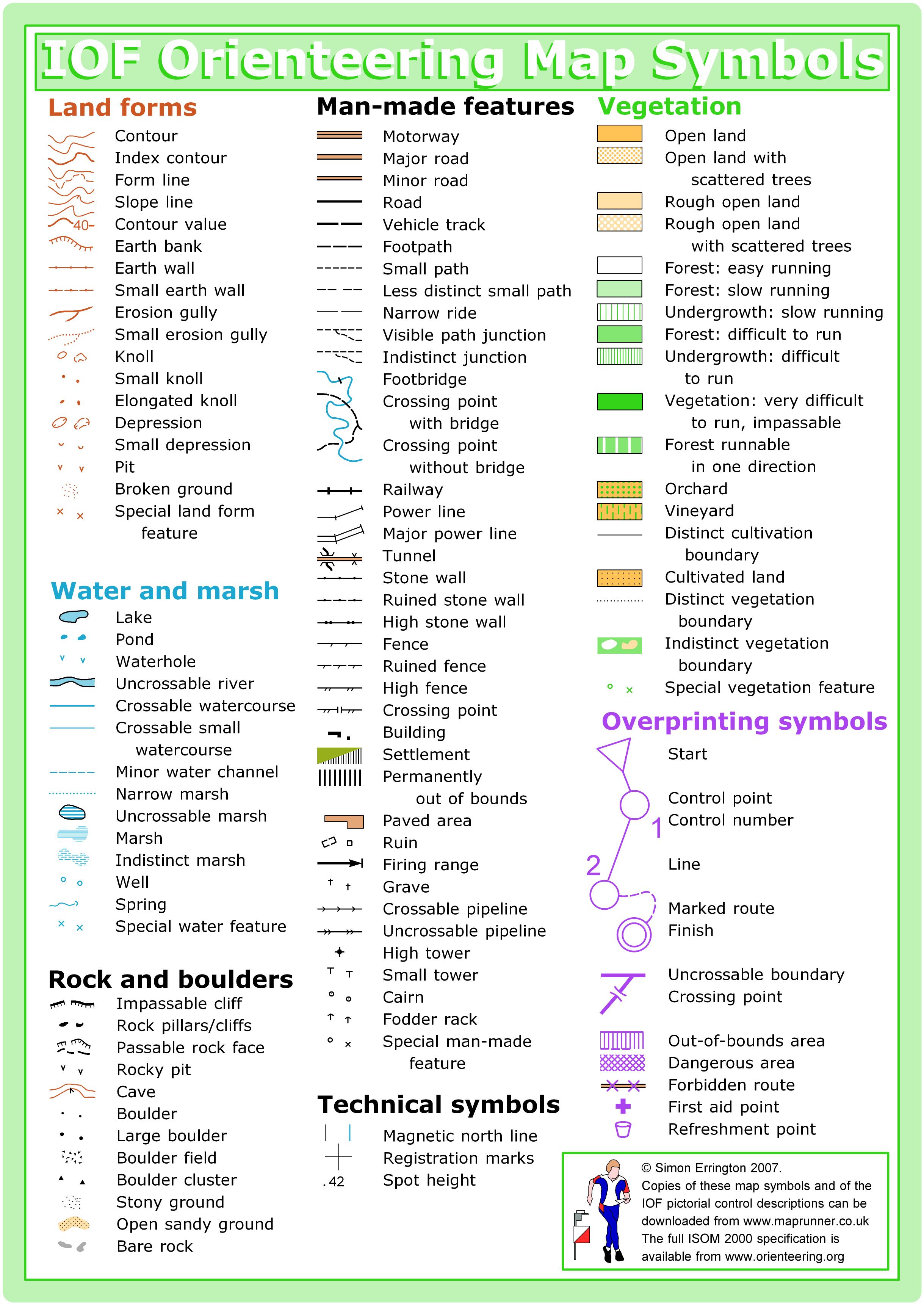
Jack Creek is a relatively small area. It covers a hillside that is rather flat and open near the campground at its western edge, and a lot of interesting landforms elsewhere. The lower part of the landscape is mostly open forest and wide open areas; elsewhere it ranges between open forest on spurs to dense vegetation in narrow valleys. You may encounter a few trails and a single forest road. It uses the ISOM 2017 symbol set with 1:10,000 scale and 5-meter contours.
Special Symbols: Green X is used most often for rootstocks, but also for stumps and logging debris piles. Green O is used for distinct trees.
Terrain and Vegetation: The map has fast and open meadows mixed with some open forest on a terrace near the main road, steeper slopes with some open runnable forest, and some less runnable terrain.
Read more on the map page
SAFETY & ETIQUETTE
Return to the Finish
All participants MUST return to the finish and download their e-punch or turn in their punch card.
Even if you have not finished your course, you must still return to the the finish and confirm with event staff that you have returned safely.
Out of Bounds
Some areas may be marked out of bounds. It is imperative to respect these boundaries to maintain our relationships with land managers. Participants MUST NOT go out of bounds. Any participant caught going out of bounds will be disqualified.
Course Closure
All participants MUST return to the finish by course closure time. If a participant does not return by course closure, event volunteers will begin coordinating a search party.
If you need a long time on the course, start as early in the start window as possible, wear a watch, and be prepared to cut your course short to make it back by the course closure time.
Whistle
All participants MUST carry a whistle on the course. Complimentary whistles are available at the start tent (please only take one).
If you are injured on the course and need assistance, blow three long blasts to call for help.
If you hear a call for help, abandon your course to find the person in distress.
Voices
Part of the fun and fairness of orienteering is navigating your own course, so please be polite when you find a checkpoint and don’t holler that you’ve found it.


